arkansas river svg
+1094 arkansas river svg cut files vector Files from our Design Marketplace.
mississippi river map
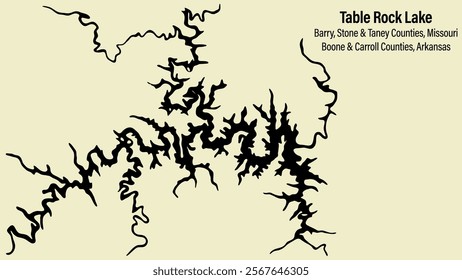
A vector map of Table Rock Lake in Missouri and Arkansas. Background, text and map are on their own layers allowing full transparency and editing.

WPA style ukiyo-e or ukiyo illustration of Arkansas River within Browns Canyon National Monument in Chaffee County, Colorado in the USA done in retro works project administration style.

Arkansas dotted map. Digital style map of the state on white background. Arkansas shape with square dots. Colored dots style. Large size squares. Creative vector illustration.
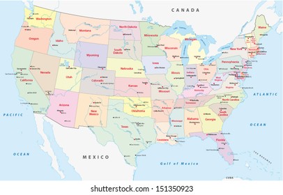
usa administrative map
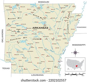
Highly detailed physical map of the US state of Arkansas
Emblem sticker logo illustration of Hot Springs National Park, Arkansas, USA.
Arkansas round logo design. State shape build of rings. Arkansas text around the state. Vector Illustration.
Wichita, Kansas Stamp. Vector Art Postal. Passport Travel Design. Travel and Business Set.
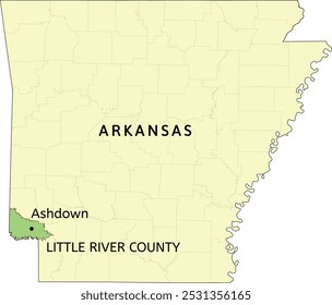
Little River County and city of Ashdown location on Arkansas state map

Map of Arkansas with counties. Just a simple state border map with county division in a green color palette. Plain State of Arkansas shape with administrative division. Vector illustration.
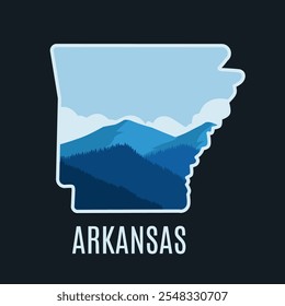
Arkansas Mountain Scenery Perfect for Print, Apparel, Sticker, etc
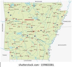
arkansas road map
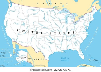
United States, rivers and lakes, political map. The main stems of the longest rivers, and the largest lakes of the United States of America, with the Great Lakes of North America. Illustration. Vector

Locator Map of the County Little River (Arkansas, US) showing the Contiguous United States with the highlighted County

Detailed vector map of Texas highlighting Bowie County, the northeastern territory bordering Arkansas and Oklahoma, featuring the city of Texarkana and the Red River.

Memphis modern vector poster. Memphis, Tennessee landscape illustration.

Arkansas state vector map featuring realistic Landsat satellite texture. This detailed illustration highlights terrain, rivers, forests, and natural land cover—ideal for educational use, infographics,

US Arkansas State Little River County Roads

Tulsa's vibrant skyline stretches across the horizon with the Arkansas River in the foreground
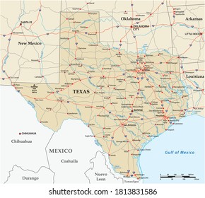
vector road map of the US state of Texas

WPA poster art of Cane Creek State Park with Bayou Bartholomew on north bank of Cane Creek Lake in Lincoln County, Arkansas, United States of America USA done in works project administration style.

WPA poster art of Cossatot River State Park Natural Area with Cossatot River in Howard County and Polk County, Arkansas, United States of America USA done in works project administration style.

Hot Springs National Park poster illustration, river forest scenery poster design
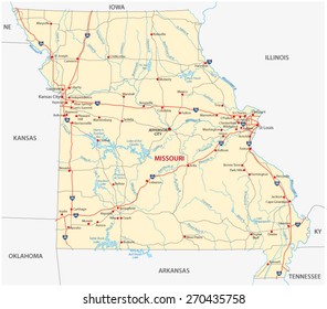
missouri road map
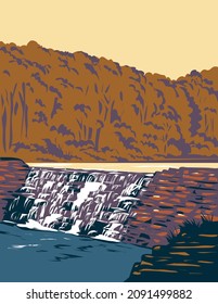
WPA poster art of Devil's Den State Park waterfall at Butterfield trail in the Ozark Mountains in northwest Arkansas, United States of America USA done in works project administration style.

Arkansas map with round title. State shape rings. Arkansas text around the state boundary shape. Elegant vector illustration.
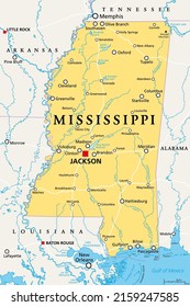
Mississippi, MS, political map, with capital Jackson, important cities, rivers and lakes. State in the Southeastern region of the United States, nicknamed The Magnolia State and The Hospitality State.
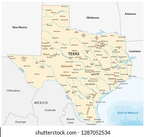
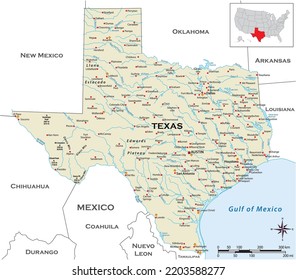
Vector Map of the U.S. state of Texas

Map of Little River County Arkansas USA Silhouette Flat and Outline Design

Arkansas dotted map. Digital style map of the state on dark background. Arkansas shape with circle dots. Colored dots style. Large size circles. Modern vector illustration.

WPA poster art of Lake Chicot State Park with oxbow lake in Chicot County within the Arkansas delta in Arkansas, United States of America USA done in works project administration style.

Detailed vector Illustration of Arkansas map State and District map with neighbour geographical map of Arkansas map
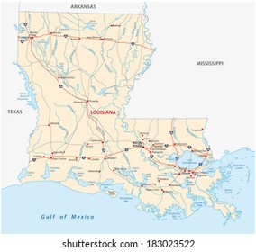
louisiana road map

Map of the County Little River (Arkansas, US) showing the Federal State with the highlighted County
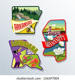
Retro illustrations of US states Louisiana, Arkansas, and Mississippi

Arkansas Fort Smith Round Seal Map Design

Arkansas Little Rock Round Seal Map Design

Arkansas Jonesboro Round Seal Map Design
Little Rock map, capital city of the USA state of Arkansas. Municipal administrative area map with rivers and roads, parks and railways. Vector illustration.
Hot Springs National Park logo patch badge illustration, river forest scenery design

Arkansas detailed and unique map outline

Arkansas Jonesboro Round Seal Map Design
arkansas hot springs vintage logo vector illustration design, waterfall logo design

Hot Spring National Park Emblem patch logo illustration
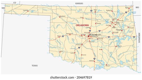
oklahoma road map
Highly detailed physical map of the US state of Texas
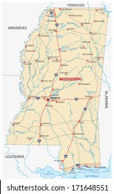
Mississippi road map
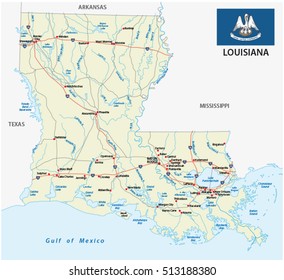
louisiana road map with flag
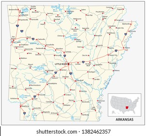
road map of the US American State of Arkansas
hot springs national park logo vector patch illustration design, arkansas emblem logo design

Arkansas dotted map. Digital style map of the state on a dark background. Arkansas shape with circle dots. Colored dots style. Small size circles. Awesome vector illustration.
arkansas hot springs logo vector vintage illustration template icon graphic design. waterfall national park landmark sign or symbol for travel business and environment concept
hot springs national park logo vector patch illustration design, arkansas hot springs logo design

Arkansas dotted map. Digital style map of the state on a dark background. Arkansas shape with square dots. Colored dots style. Small size squares. Creative vector illustration.

Arkansas shape built of colored cells. Digital style map of Arkansas on a dark background. Small size rounded square blocks. Plain vector illustration.
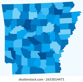
Map of Arkansas with counties. Just a simple state border map with county division. Light blue color palette. Blank State of Arkansas shape with administrative division. Vector illustration.

Detailed circular outline map of Arkansas with the flag

WPA poster art of Bull Shoals-White River State Park with the best trout fishing stream in Baxter and Marion Counties in Arkansas United States done in works project administration style.
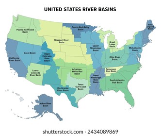
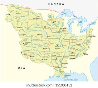
United States major river basins, political map. Nineteen major river basins, highlighted in different colors. Map with the silhouette of the USA, also showing the borders of the individual states.
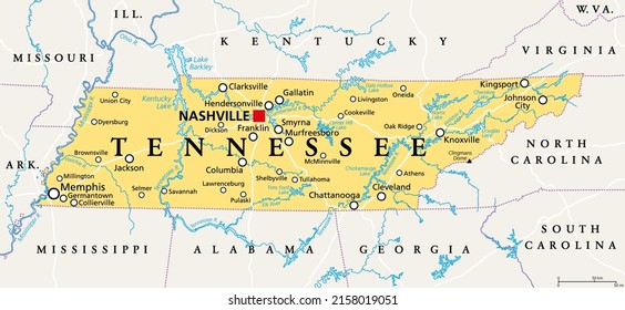
Tennessee, TN, political map, with capital Nashville, largest cities, lakes and rivers. State of Tennessee. Landlocked state in Southeastern region of the United States, nicknamed The Volunteer State.
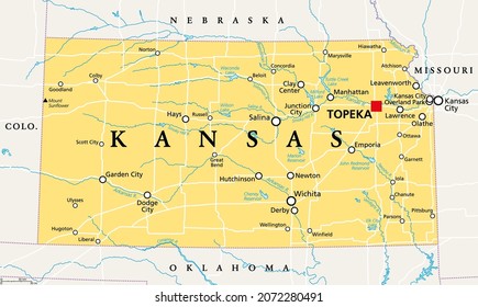
Kansas, KS, political map with capital Topeka, important rivers and lakes. State in the Midwestern United States of America nicknamed The Sunflower State, also The Wheat or The Jayhawker State. Vector
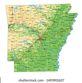
High detailed Arkansas physical map with labeling.
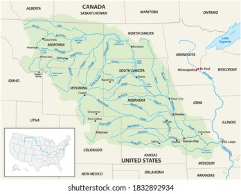
Vector map of the Missouri River Drainage Basin, United States, Canada
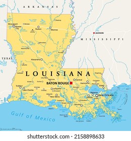
Louisiana, LA, political map, with capital Baton Rouge and metropolitan area New Orleans. State in Deep South and South Central regions of the United States, nicknamed Pelican, Bayou and Creole State.

High-quality vector map of the United States with Arkansas highlighted in gold. Great for educational use, presentations, and regional design projects.
Arkansas State, USA. Highlighted map on Arkansas. Editable blank vector map of USA

Building view with landmark of Little Rock is the city in Arkansas. Hand drawn sketch illustration in vector.
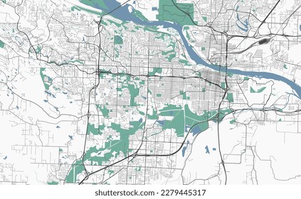
Urban vector city map of Little Rock, USA. Arkansas state capital
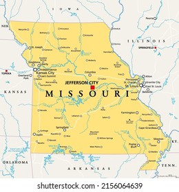
Missouri, MO, political map, with capital Jefferson City, and largest cities, lakes and rivers. State in Midwestern region of United States, nicknamed Show Me State, Cave State and Mother of the West.