boston map svg
+1790 boston map svg cut files vector Files from our Design Marketplace.
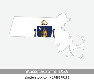
Massachusetts Map Flag. Map of MA, USA with the state flag isolated on white background. United States, America, American, United States of America, US State. Vector illustration.
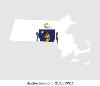
Massachusetts Map Flag. Map of MA, USA with the state flag. United States, America, American, United States of America, US State Banner. Vector illustration.

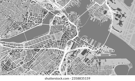
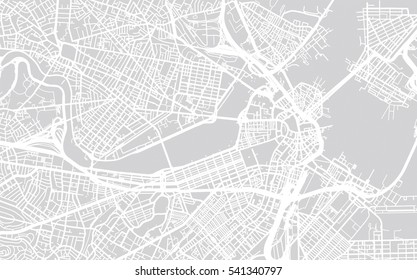
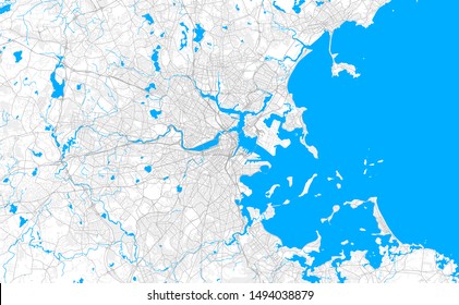
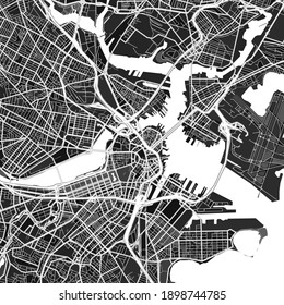
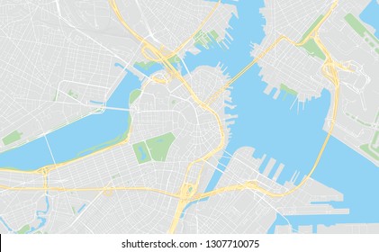
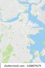
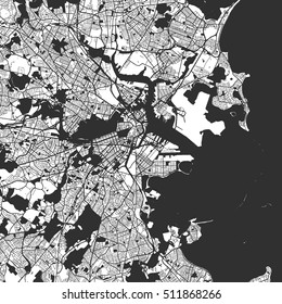
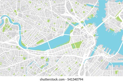
Vector city map of Boston Metro Massachusetts in the United States of America with white roads isolated on a grey background.
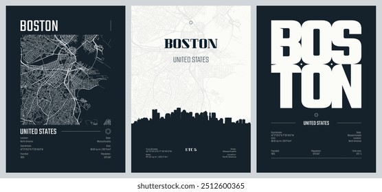
Set of travel posters with Boston, detailed urban street plan city map, Silhouette city skyline, vector artwork, set 2

Layered editable vector illustration of map outlines of ten US state capital cities
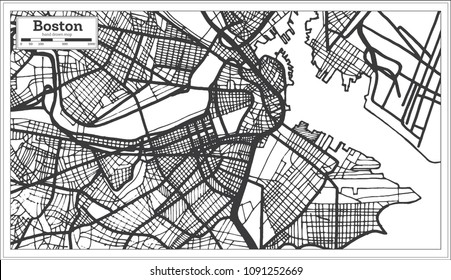
Map of Boston city, United States. Urban black and white poster. Road map image with metropolitan city area view.

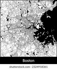
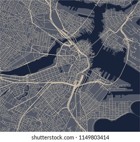
Vector city map of Boston Center Massachusetts in the United States of America with white roads isolated on a black background.
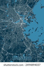
Urban city map of Boston, USA

vector map of the city of Boston, USA
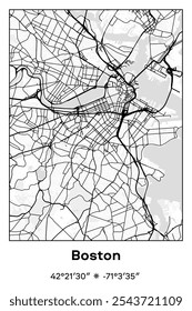
Editable vector poster map of Boston,Massachusetts, showcasing detailed street layouts, main roads, neighborhoods, and landmarks in Black, white, gray colors.
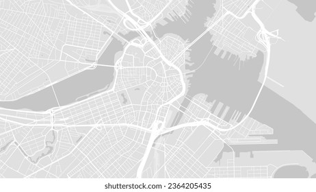
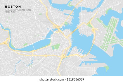
Background Boston map, United States, white and light grey city poster. Vector map with roads and water. Widescreen proportion, digital flat design roadmap.
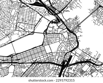
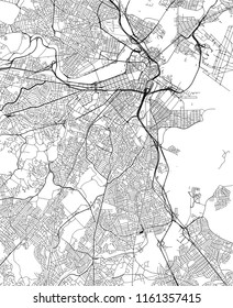
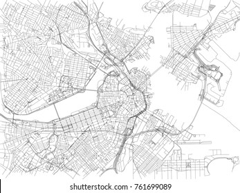
Vector city map of Boston Center Massachusetts in the United States of America with black roads isolated on a white background.
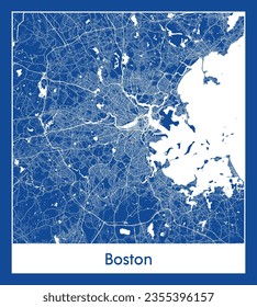
City Map Boston United States North America blue print round Circle vector illustration

Boston, Massachusetts, USA map poster art
vector map of the city of Boston, USA
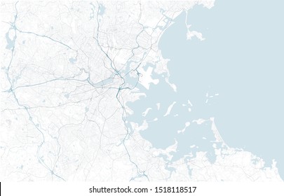
Satellite map of Boston and surrounding areas, Usa. Map roads, ring roads and highways, rivers, railway lines. Transportation map
vector map of the city of Boston, USA

Illustrated map of Boston, Massachusetts, USA with landmarks and symbols. Vector cartoon design for frame arts, posters, prints

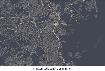
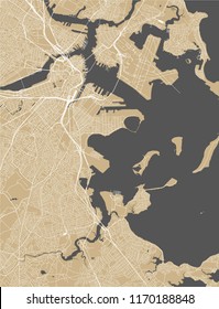
Vector city map of Boston Metro Massachusetts in the United States of America with white roads isolated on a black background
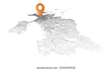
Boston,United States of America,isometric detail Streets Roads Map with location pin, element image

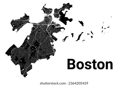
Silhouette map of boston city, capital of Massachusetts.
Boston, Massachusetts, USA artistic blueprint map poster
Boston Massachusetts map in usa
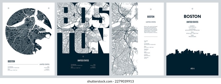
Set of travel posters with Boston, detailed urban street plan city map, Silhouette city skyline, vector artwork

New Hampshire vector map. High detailed illustration. United state of America country.

Massachusetts outline contour map. Easy recolour and edit picture.
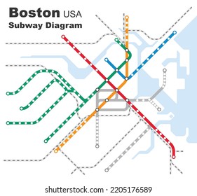
Layered editable vector illustration of the subway diagram of Boston,USA.
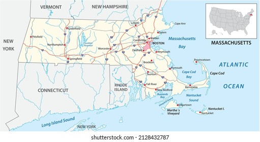
road map of the US American State of Massachusetts

Set of Massachusetts map, united states of america. Flat concept icon vector illustration .
Boston city map, United States. Municipal administrative borders, black and white area map with rivers and roads, parks and railways. Vector illustration.
Boston map, American city. Municipal administrative area map with rivers and roads, parks and railways. Vector illustration.
City Map Boston United States North America vector illustration
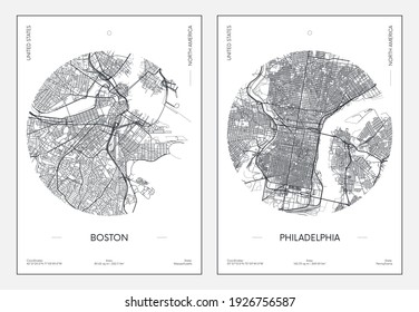
Travel poster, urban street plan city map Boston and Philadelphia, vector illustration
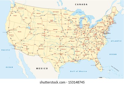
us interstate highway map
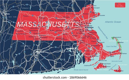
Massachusetts state detailed editable map with cities and towns, geographic sites, roads, railways, interstates and U.S. highways. Vector EPS-10 file, trending color scheme
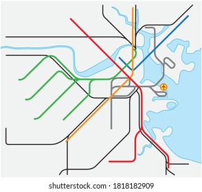
subway vector map of Boston, Massachusetts, United States

City Map Boston United States North America round Circle vector illustration
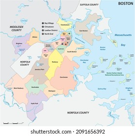
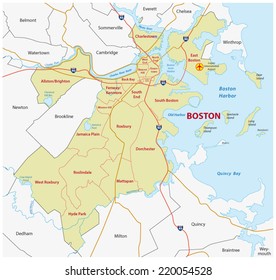
Boston, Massachusetts, United States, neighborhood map
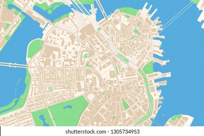
Rich detailed vector area map of Boston, Massachusetts, U.S.A.. Map template for home decor.
Streets of Boston, city map, Massachusetts, United States. Street map
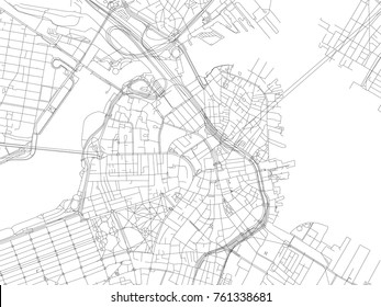
Printable streetmap of Boston including highways, major roads, minor roads and bigger railways. The name of the city and the geographic data are grouped and can be removed if they are not needed.
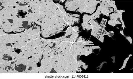
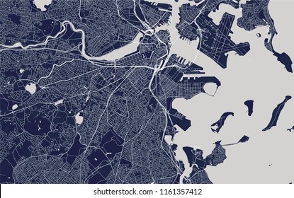
Dark vector art map of Boston, Massachusetts, UnitedStates with fine gray gradations for urban and rural areas. The different shades of gray in the Boston map do not follow any particular pattern.
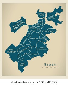
Modern City Map - Boston Massachusetts city of the USA with boroughs and titles
us interstate highway, administrative and political vector map
Boston, Massachusetts, classic colors, printable map, designed as a high quality background for high contrast icons and information in the foreground.

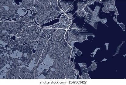
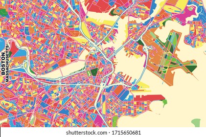
Color art map of Boston, Massachusetts, UnitedStates in blues and oranges. The color gradations in Boston map follow a random pattern.
Boston Massachusetts printable map excerpt. This vector streetmap of downtown Boston is made for infographic and print projects.
vector map of the city of Boston, USA

Satellite map of Boston, Massachusetts, city streets. Street map, city center. Usa

Simple map of Boston, Massachusetts, USA. Black and white version for clean backgrounds and prints. This map of Boston contains three markers who are grouped and can be moved separetly
vector map of the city of Boston, USA
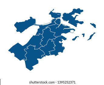
Outline map of Boston districts
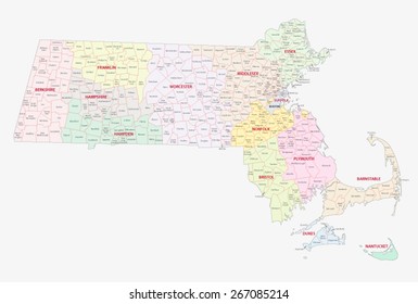
massachusetts counties, cities and towns map
City map Boston, color detailed plan, vector illustration
vector map of the city of Boston, USA
Boston Monochrome Map Artprint, Vector Outline Version, ready for color change, Separated On White
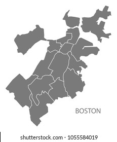
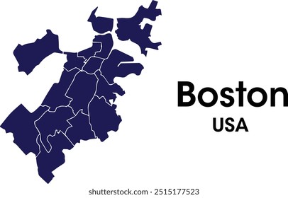
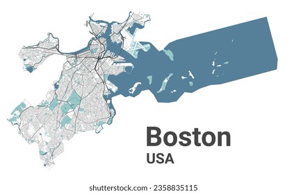
Boston Massachusetts city map with boroughs grey illustration silhouette shape

Modern City Map - Boston Massachusetts city of the USA with boroughs
Streets of Boston, city map, Massachusetts, United States. Street map
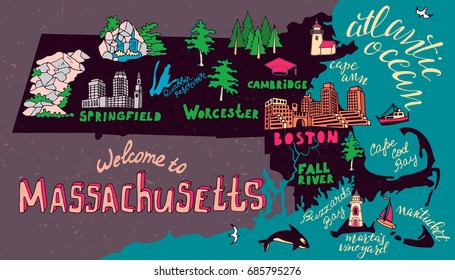
Illustrated map of Massachusetts state, USA. Travel and attractions
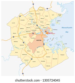
vector map of the Greater Boston metropolitan region, Massachusetts, united states
Urban city map of Boston, USA
vector map of the city of Boston, USA
City map Boston, travel vector poster design

Boston Massachusetts city map grey illustration silhouette shape
Colorful vector map of Boston, Massachusetts, U.S.A.. Art Map template for selfprinting wall art in landscape format.
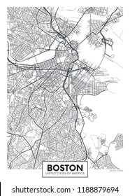
Boston USA City Map in Retro Style. Outline Map. Vector Illustration.
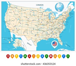
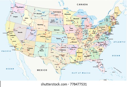
Highly Detailed Map of United States. With cities, roads, lakes, rivers, states, Alaska and Hawaii.
vector map of the city of Boston, USA
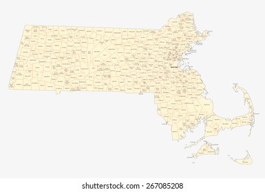
massachusetts cities and towns map

Map of Boston City flat Illustration
boston administrative map